
Monday, 12 November 2012
Autumn walking
Wednesday, 15 August 2012
Tajos de la Virgen


Saturday, 14 July 2012
River walks in the Sierra Nevada


Tuesday, 15 May 2012
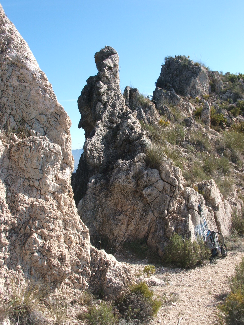
The Rio Lanjaron valley


Saturday, 14 April 2012
Moorish Castles


I was out with clients from the UK over the Easter week and as ever it rained which always seems to be the way for Semana Santa. We did however manage to get some great walking in and as my clients didn’t particularly want to just get into the high mountains I was able to take them around some of the better low level walks in the area thus avoiding the worst of the forecasted rain and doing some great walks as well. During a couple of the days the routes led us by or even through the ruins of Moorish castles which reminded me of the number of such ruins to be found in the lower hills and mountains of the area.
One of the best examples that I know of and which we included in a walk last week is the castle above the village of Guajar Faraguit in the Los Guajares valley which runs west off the Granada/Motril motorway. The castle is easy enough to locate as it is well signed out of the village. The route descends the valley side to cross the Rio Toba before a steep ascent on a good path through terraces covered in orange trees. After climbing for about twenty minutes you reach a fairly narrow ridge about 100m above the river which has the castle ruin perched at its eastern end. It is clear as you peer back down the steep slope on three sides of the castle, that this makes a fantastic defensive position. Protected by some basic earthworks across the ridge and four towers around its walls walls, the complex was made up of a group of about a dozen small buildings and food stores within its walls. There is even an aljibe (water tank) with an acequia leading to it across a mini aqueduct built along the ridge. The site is reminiscent of a small well defended hamlet than a castle and it’s easy to imagine people from the surrounding area gathered here in order to protect themselves and their families from enemies.
Unlike some of the stone built castles in the area, such as the one in Lanjaron, this castle is made from a very early type of concrete. It is clear, looking at the walls, that some type of scaffolding and a former were used to allow the material to be held in place as it set, creating a wall in places about a meter thick and probably 4-5 meters high at the towers. The ‘interior’ walls of the buildings also seemed to have had some form of render which even at this age was smoother than the inside of my cortijo!
Thursday, 22 March 2012
El Torcal, Via ferrata


A well protected via ferrata route in the limestone of El Torcal Parque Nacional. The route has three pitches, the first of which is slightly overhanging and very sustained. The sting in the tail is a tyrolean traverse linking the butress which holds most of the route to the main face.
Wednesday, 14 March 2012
Sierra de Huetor scrambles


I recently took out some clients who specifically wanted to do some scrambling, which for the uninitiated comes somewhere between steep walking and climbing. It involves getting your hands on rock and getting off whatever beaten path there might be under your feet. In the UK the most famous scrambles are perhaps Striding Edge on Helvellyn and Grib Goch on Snowdon. As ever in Britain there are guide books giving directions and details of the routes and their grades, these are often supported by nice drawings and photos so it’s relatively easy to find routes and have some idea of the difficulties you face. Unfortunately it’s not as easy here. The first problem is finding an area which has potential for routes. The main Sierra Nevada range doesn’t. The rock is friable and often frighteningly loose. There are some high ridges which offer potential but at this time of year these are graded as Alpine climbs as they are covered in ice.
It’s similar in the Axarquia area where what look like great ridges turn out to be made up of fairly crumbly limestone. So where to go? Whilst the Lecrin valley offers some short routes on Giralda and elsewhere, the best area I have discovered locally is the Sierra de Huetor. This is an area of ‘’Parque Naturale’’ which lies north of the Granada – Almeria motorway. Here a series of limestone cliffs and ridges provide a range of routes from easier grade ones to a fairly spectacular grade three. This route which I usually do at the end of a day climbs up the eastern rib of Majalijar (1878m) finishing on its airy summit.
On the run up to the trip I had been out the week before and ‘’discovered’’ a couple of new routes to add to the collection. Whilst doing some exploration along a ridge to the north of the main summit, on a line which proved to be disappointing, I got a bit ,of a scare. Coming over one of a series of small outcrops I nearly stepped onto a sleeping wild boar. Luckily it heard me at the last minute as all I saw was it leaping off the ground and throwing itself down a small gully off the ridge. From what I could see it was about 18’’ high so I presume it was one of last year’s young which had been lying up in a grassy hollow along the ridge where it felt safe. I have always assumed that unless you are unlucky enough to come across a mother and young, that boar, like other wild animals will try to avoid contact and judging from the speed that this one disappeared away from me I may well be right.
Thursday, 2 February 2012
Ridge walk in the Sierra Chaparral.

On a recent exporatory walk in the Sierra Chaparral inland of Salobrena on the Costa Tropical I discovered a very well constructed path which runs just below a magnificent ridge line east from La Guindalera. A great ridge with some potential for short scrambles though with some very aggresive vegetation en route.
Sunday, 29 January 2012
Via feratta in Andalucia


Recently a number of new via feratta routes have been created in Andalucia. many are around the Rhonda area but others are further east nearer malaga. For more information see http://deandar.com/ferratas/
Tuesday, 17 January 2012
Acequia walks


Many of us who live in the countryside areas around the Sierra Nevada rely upon the acequia system to bring us much needed water. For those not in the know, acequias are man-made water channels which run throughout the area bringing water to lower agricultural land They are often essential, allowing us to grow fruit and veg., fill swimming pools (perhaps illegally) shower or even wash the car.
Thought to have been fully developed by the Moors when they ruled the area, the system probably reaches further back into history. It seems obvious that digging channels to route water to where it was most needed must have gone on for millennia in order to make the most of what is a precious resource. The system has spread across the whole of the region with hundreds of channels creating a massive irrigation system that feeds the whole of the area. On my hillside alone there are four major acequias channels. The Acequia Alta which ultimately feeds my cortijo, runs directly from the Rio Lanjaron at about 1,400m and traverses the hillside before it finishes above the Tablate gorge about whole 10km from its start. En route, sluices allow the water to be managed and fed down a network of smaller and smaller channels before ultimately watering my lettuce.
When walking in the region most of us will have come across acequias. Often with a path alongside, they can provide relatively easy walking routes along steep hillsides and river valleys reaching into the mountain ranges of the area. Whilst providing easy graded walks, they sometimes have short steep sections where the channel itself will be sent down rock outcrops in order to change the level at which it runs. Sometimes however they give much more dramatic walking as they pass through rather than down an outcrop. If you do come across these sections it seems incredible that the original builders had the skill to create these parts of the system. I must admit I actually seek out some of the more dramatic bits and have found many during my exploration of the area.
Some of the best are actually on the Acequia Alta where about 2km from the river the acequia clings to high cliffs above a vertical drop of about 50m. These sections are unfenced and if crossed when the water is flowing are breathtaking. Another dramatic section is found in the Rio Chillar gorge near Nerja. Here the acequia cuts through cliffs high on the east side of the valley. The ‘’path’’ is about a foot wide and runs around the cliffs as the water channel itself runs through on a narrow tunnel. Even though these sections are fenced they still need a good head for heights.
Perhaps one the most used routes is that through the Monachil Gorge. Here though, you may not know it, the channel is covered for most of its length and the acequia takes you through dramatic natural rock scenery.
Monday, 16 January 2012
The Sierra Nevada range

To many British walkers the Sierra Nevada is still a bit of an unknown quantity. Indeed until It wasn’t until I started visiting the area some ten years ago, then moving here six years ago and began working as a mountain guide ago that I began to understand the scale and range of this massif.
Hopefully this piece will shed a little light on what is a fantastic mountain range which is ideal for walking and trekking all year round. A few facts to start with. The range itself is effectively a 100km long escarpment running east from Granada. The steeper north side of the range holds some dramatic corries and steep rock ridges whilst more gentle southern slopes, divided by deep lusher river valleys, lead down to the Alpujarra, an area of white villages and olive groves. The highest point in the range is Mulhacen which at 3,482 m also claims the title of being the highest point in mainland Spain. This summit lies only 35km north from the Mediterranean coast a fact which, combined with the overall height of the range creates one of the rarest and most fragile mountain habitats in Europe. The proximity of the coast also means that you can walk the high peaks in the morning and swim in the Mediterranean in the evening.
Walking and trekking here is usually a non technical affair. These mountains lend themselves to long days along soaring ridges with major peaks en route or ascents of deep river valleys leading to the flanks of the high peaks. The classic traverse of the whole of the range, ‘’ruta de trese tresmiles’’ picks off some of the ranges twenty or more 3,000m summits and is a tough multi day trip. Generally undertaken from the east it involves about 60km of hard walking and overnight camps. Most walkers however stick to the western end where the big three summits of Valeta ( 3394m) Mulhacen and Alcazaba (3371m) are to be found.
Valeta, a classic shark’s fin summit stands above Granada’s Sol y Nieve ski resort. Easily accessed from the west this is a popular ascent and also gives access to the old mountain track which until 1995, when these mountains were designated as a national park, traversed the western end of the range at around 3,000m. Now used as a key walking and mountain biking route the track once allowed car access to these high peaks.
Mulhacen can be climbed in a day from the trail head above the village of Capileira in the Poqueira gorge on the south side of the range. A better ascent though is to do it over two days using the very well sited Poqueira refuge. This well run and popular refuge sits at 2,500m on the southern slope of the mountain and provides an ideal base for ascents via the steep west ridge.
Alcazaba or ‘’The Fortress’’ lies east of Mulhacen and can be climbed in a day from the refuge. The most remote and rugged of the big three it towers over the remote hanging valley of Siete Lagunas a popular site for wild camping. Accessed via its south ridge the summit itself has 400m cliffs on the north side dropping dramatically down into the Rio Genil valley.
A short break in the Pyrenees

For those who haven’t been the Pyrenees might come as a bit of a surprise. The peaks span the French/Spanish border and are rugged and ‘alpine’ in nature. Though never higher than the Sierra Nevada there are over two hundred 3,000m+ peaks plus numerous smaller mountains and hills. The area has a long tradition of mountaineering which is reflected in the number of trails and routes and also the network of mountain huts available to walkers. It was in two of these huts that together with an old friend from the UK I spent a few days exploring the area around a village called Benasque.
The first hut, Refugio de Estos was a days walk in form the road through alpine meadows and wild flowers. Staying in a mountain hut over a busy weekend has to be experienced to fully appreciate. Bedrooms are often communal, ours had three tiers of sleeping platforms with around 40 people in, some of whom where up at half five to set off to do Posetts one of the main peaks in the range. We however had a late start by comparison (7.00am) and headed for a more leisurely ascent of Pico de Clarabide a mere 3,006m perched right on the border.
The second hut we used was the Renclusa on the north side of Aneto which at 3,404m is the highest point in the whole range. Like many huts this has no road access and here the supplies are brought in daily by two mules. Again the hut was crowded but luckily we had individual bunks however we did this time succumb to an ‘alpine’ start and had breakfast along with many others going for the summit at 5.00am.
The initial ascent across a very steep boulder field which led to a gully filled with scree and loose rocks. The gully was potentially the most dangerous section of the whole route. About a dozen ascending it at the same time meant that dodging loose rocks whilst trying to keep upright was essential.
Along with a few other peaks in the range Aneto still holds a small section of glacier. The crossing is easy and well marked and after the gully came as a relief. The summit itself is magnificent, if a bit crowded with the summit cross itself is reached by a short but very exposed scramble across a knife edge ridge which many people didn’t do, understandable when you saw the drop.
A problem on Aneto like many other ‘highest peaks’ is that many people go unprepared and just want to bag the summit. This was perhaps best illustrated by the number of young Spanish walkers who went up in trainers (!!!) with crampons attached. I sight I’d never seen before I must admit.
Cabra de Montana

Last week I went with a few friends and again climbed Travenque a superb mountain east of Granada. After a steep ascent the final few meters offer a short scramble to a truly dramatic summit. The view east to Valetta, Caballo and the ski resort is one of the best in the range.
As often happens during a trip in these mountains during the walk we spotted a small herd of ‘’cabra de montana’’. Many of you will have seen herds of these ‘’mountain goats’’, normally running away into the distance. For those who haven’t these truly wild animals are about the size of a fallow deer, they are a tan colour with darker shoulders and haunches with the larger older animals having a pair large sweeping horns. Well suited to the mountain terrain where they are generally found they have short muscular legs and large soft hooves which are perfect for gripping steep rock faces. Generally browsers they live in areas of mixed scrub and broken ground in the lower mountains but I have seen them at 3,000m near the Caldera refuge on Mulhacen, on the edge of Lanjaron and also on the coast near Cerro Gordo. Often the only sign you have that they are in the area are large amounts of droppings on summits though you will often hear a sharp high pitched call as outlying individuals warn a larger group that you are approaching.
The groups you see will either be made up of females with their young or males. The two groups do not generally mix apart from the breeding season in autumn. This is also the time when males fight for dominance of a herd with head butting contests.
My first sighting of ‘’cabra’’ was about 10 years ago whilst descending the south ridge of Mulhacen. Needless to say seeing one of these animals for the first time was quite a shock particularly as it was quite a large male with a fantastic pair of horns. I have become accustomed to looking out for them but even so it’s often not until they move that I spot them as they are well camouflaged and blend into the backgrounds remarkably well.
Whilst often called mountain goats these animals are actually a type of Ibex, Capra pyrenacia . At one time there were a total of four subspecies. One, a Portugese subspecies, died out in 1892. Shockingly the other, Capra pyrenaica pyrenaica, became extinct on the 6th January 2000. A remarkably specific date. However this was when the last known specimen of a subspecies peculiar to the Pyrenees died. A frightening example of how easily we can loose unique animals. The two remaining subspecies however seem to be doing well and at the moment at least appear to be growing in numbers with an estimated population across the Iberian Peninsula of about 50,000.
Next time you’re out in the mountains take time out to try to spot these remarkable animals.
Subscribe to:
Posts (Atom)